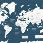
Understanding UPS Ground Zone Maps
UPS Ground Zone Maps are a crucial element in the shipping process, defining the various shipping zones within the United States based on the locations of the shipper and the recipient. These zones determine the distance a package must travel from its origin to its final destination, which in turn influences the shipping cost and delivery time. By leveraging UPS Ground Zone Maps effectively, businesses and individuals can optimize their shipping strategies to save on costs and ensure timely deliveries.
What are UPS Ground Zone Maps?
UPS Ground Zone Maps categorize the United States into distinct shipping zones, primarily based on postal codes or zip codes. Each zone corresponds to a specific distance from the shipment's origin. The zones are typically numbered from 2 to 8, with Zone 2 representing the nearest areas and Zone 8 covering the farthest regions. These mappings are essential for calculating shipping rates, as higher zones generally incur higher shipping costs due to the increased distance.
UPS regularly updates its Ground Zone Maps to reflect changes in postal codes and shipping routes, ensuring accurate and competitive shipping rates. To assist users, UPS offers an online Zone Locator tool where you can enter specific zip codes to determine the corresponding shipping zone and estimate delivery times.
How do UPS Ground Zone Maps Work?
The functionality of UPS Ground Zone Maps is based on distance-based pricing. When calculating shipping and handling charges, UPS considers the weight, dimensions, and distance of the package. The further the package needs to travel, the higher the shipping zone, leading to increased shipping rates. For instance, shipping a package from New York (Zone 2) to Los Angeles (Zone 8) will cost more than shipping it within the same region.
UPS provides various tools and resources, including online calculators and shipping software, to help customers determine the most cost-effective shipping options. Additionally, services like UPS My Choice allow customers to customize delivery preferences and receive real-time updates on their package's status, enhancing the overall shipping experience.
Importance of UPS Ground Zone Maps
Understanding UPS Ground Zone Maps is vital for any shipping strategy, especially for businesses that rely heavily on shipping for their operations. These maps offer a transparent view of shipping zones and estimated delivery times, enabling businesses to make informed decisions about their shipping methods. By accurately identifying the appropriate shipping zones, businesses can:
- Optimize shipping costs by selecting the most economical shipping zones.
- Ensure timely deliveries, thereby enhancing customer satisfaction.
- Plan shipments more efficiently by understanding delivery timelines.
- Improve overall operational efficiency and profitability.
For more insights on how shipping zones impact costs and delivery times, refer to the UPS Shipping Rates Guide.
Using UPS Ground Zone Maps for Shipping
Planning Your Shipment
To utilize UPS Ground Zone Maps effectively, enter the origin and destination zip codes into the UPS online tool. This will provide you with the relevant shipping zone, estimated delivery time, and associated shipping rates based on the service level selected. This information is crucial for selecting the appropriate service level that balances cost and delivery speed.
Optimizing Shipping Costs
Here are some strategic tips to minimize shipping costs using UPS Ground Zone Maps:
- Package Weight and Dimensions: Smaller and lighter packages generally incur lower shipping fees.
- Ship During Off-Peak Times: Shipping rates can be lower during periods of reduced demand.
- Efficient Packaging: Use packaging that fits your product snugly to avoid unnecessary bulk and reduce costs.
- Compare Service Levels: Evaluate different UPS service levels to find the most cost-effective option that meets your delivery requirements.
- Leverage UPS Tools: Utilize UPS's online tools to print labels and schedule pickups, which can help reduce transportation costs.
Additionally, consider strategies like establishing warehouses or fulfillment centers closer to high-demand zones to further reduce shipping distances and costs.
Limitations and Considerations
Limitations of UPS Ground Zone Maps
While UPS Ground Zone Maps are highly useful, they come with certain limitations:
- Estimated Rates: The rates provided are estimates and may not account for additional fees such as fuel surcharges or special handling fees.
- External Factors: Weather conditions and carrier delays can impact delivery times, which are not reflected in the zone maps.
- International Variations: Shipping rates and zones can vary significantly when dealing with international shipments due to differing regulations and taxes.
Common Mistakes to Avoid
To maximize the benefits of UPS Ground Zone Maps, avoid the following common mistakes:
- Incorrect Zip Codes: Always verify the accuracy of the origin and destination zip codes to prevent miscalculations in shipping costs and delivery times.
- Ignoring Additional Fees: Be aware of potential additional charges that can inflate the total shipping cost.
- Overlooking Service Levels: Selecting a service level solely based on cost without considering delivery speed can negatively impact customer satisfaction.
- Using Outdated Maps: Ensure you are using the latest version of the UPS Ground Zone Maps to avoid errors due to changes in postal codes or shipping routes.
Alternatives to UPS Ground Zone Maps for Shipping Optimization
While UPS Ground Zone Maps are reliable, exploring alternative tools can further enhance your shipping optimization efforts:
- Third-Party Shipping Software: Solutions like ShipStation offer multi-carrier pricing, shipment tracking, and label generation.
- Freight Forwarders: Services such as Flexport specialize in transporting large and heavy items, often providing cost-effective rates.
- Carrier Rate Shopping Services: Platforms like Shippo compare rates from multiple carriers, allowing you to choose the best option based on price and service level.
- Electronic Data Interchange (EDI): Implementing EDI facilitates seamless communication between your business and shipping providers, streamlining the shipping process.
Frequently Asked Questions about UPS Ground Zone Maps
What is the difference between UPS Ground and UPS air services?
UPS Ground is a domestic shipping service that delivers packages within one to five business days, depending on the distance. In contrast, UPS air services like UPS Next Day Air or UPS 2nd Day Air offer faster delivery options at higher costs.
How do I know if a shipment is impacted by weather or carrier delays?
You can monitor the status of your shipment through the UPS Tracking tool on their website or contact UPS customer service for real-time updates and information on any delays.
Can the shipping rates vary depending on the country of origin or destination?
Yes, shipping rates can vary based on the country of origin or destination due to factors like local regulations, taxes, and additional handling fees. Always consult the UPS website or contact customer service for the most accurate and updated shipping rates for international shipments.
By effectively understanding and utilizing UPS Ground Zone Maps, you can make informed shipping decisions, reduce costs, and ensure that your packages are delivered efficiently and on time. Implement these strategies to enhance your shipping operations and maintain a competitive edge in your business.


